
Locating the exact route of a home’s pipes requires cross-checking several sources of information, none of which is sufficient on its own. Original construction plans, data from the wastewater service and on-site surveys each address part of the problem, but their reliability depends on the age of the property and any changes made since it was built.
Private connection and public network: two areas to distinguish
The “Réseaux et canalisations” online service, hosted by INERIS, lists public networks affected by construction work and supports the DT-DICT procedures. It does not cover the connection between the public sewer and the house, or pipes located within the property boundary.
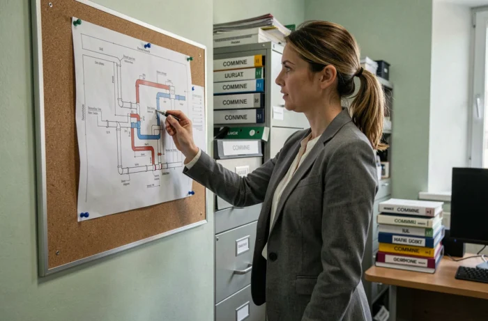
For private networks, the document to request is the connection plan issued by the local wastewater service. It shows the connection point, pipe diameter and, where data is available, the invert level at the inspection chamber by the front of the house. Contact the local authority or its appointed operator (municipal utility, intermunicipal association or private operator) responsible for the public sewer network in the municipality.
Documenting a drainage and pipe network plan for a detached house therefore means contacting two separate parties: the public network operator for the connection, and the builder or previous owner for the network within the property.
Public or private wastewater treatment: two very different processes
For properties connected to the public sewer, the wastewater service keeps connection plans and connection data on file. A written request or visit to the town hall’s technical department is generally enough to obtain a usable map extract.
For properties with an individual wastewater treatment system, the key document is the SPANC inspection report (Public Service for Non-Collective Sanitation). It describes the septic tank, filter and drainage field, specifies their location on the property and assesses whether the system complies with regulations. If the original plans have been lost, this report is often the only reliable source of information.
Sending your request to the wrong department wastes time. SPANC only handles individual wastewater treatment systems. The wastewater service only manages properties connected to the public sewer.
Original construction plans: how to find them if the file is missing
Building permit files archived at the town hall can still be consulted by contacting the planning department.
- The builder or project manager may have kept a copy of the network installation plan, including the routes of wastewater and stormwater pipes and the drinking water supply.
- The notary who handled the sale may have a wastewater inspection report attached to the deed, along with a diagram of the system.
- The previous owner is another direct contact: pipe plans are sometimes filed with the construction documents handed over when the property was sold.
An original plan does not necessarily reflect the network’s current condition. Any extension, renovation or alteration that has not been recorded makes the document obsolete. Connections added later to serve a garage or outbuilding will not appear on it.
Check whether an old plan is accurate
Comparing the plan with the inspection chambers visible on the ground can reveal discrepancies. If the number of chambers does not match the junctions shown on the plan, an undocumented alteration has probably been made. An additional site survey is then required.
Site survey and camera inspection: reconstructing the actual route
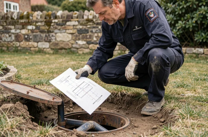
If no usable plan is available, or the document is clearly incomplete, two on-site techniques can be used to reconstruct the network as it exists today.
Endoscopic camera inspection is carried out through an inspection chamber or plumbing fixture. It identifies the route, changes in direction, connections and any potential issues (backfall, root intrusion or breaks). The contractor provides a georeferenced video report that can be used to create an updated plan.
Ground-penetrating radar or electromagnetic detection locates buried networks without excavation. Ground-penetrating radar can detect PVC or stoneware pipes, which conventional electromagnetic detectors cannot pick up. These surveys are carried out by companies certified in utility locating.
- Camera inspection covers the network accessible from inside the pipes and also provides information about their structural condition (cracks, water ingress).
- Ground-penetrating radar covers inaccessible or unconnected networks, including capped-off ducts and abandoned pipes.
- Combining the two methods produces a complete plan, even for networks the owner did not know existed.
When to arrange a site survey
Before any construction project (an extension, swimming pool or raised deck), a site survey helps prevent accidentally cutting through a buried pipe. Carrying out work without first locating the pipes on a property with an incomplete plan can lead to costly damage and a work stoppage.
Wastewater inspection when selling a property
For properties with an individual wastewater treatment system, the SPANC report is required when the property is sold. For properties connected to the public sewer, some local authorities require a compliance inspection of the connection, although this requirement does not apply across the country.
This inspection report is a useful source of information for the buyer: it locates the system, assesses whether it complies with regulations and identifies any work required. Requesting it from the seller or notary before signing provides an up-to-date map of the wastewater network on the property.
Finding a home’s wastewater and pipe plans requires a structured approach: identify the type of system (public sewer or individual treatment), contact the right party (wastewater service, SPANC, town hall or builder), then compare the plan with the actual site. If the original file is missing, camera inspection and ground-penetrating radar can provide a reliable map, provided the work is entrusted to qualified operators.